Our services

sounding box

General Geology

We provide all types of advice in the field of geology, hydrogeology, Geomorphology, geological cartography, stratigraphy, applied geology, etc… We carry out field and laboratory tests related to carrying out Geological Studies, Hydrogeological and Geotechnical for the control of work and materials used in construction.

Geotechnics

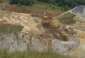
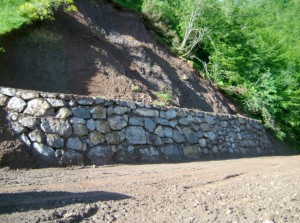
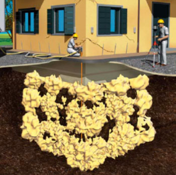
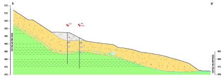
Geotechnics is the discipline that deals with the behavior and response of soil materials to human or natural action.. The establishment of a behavioral model that serves to design or project the necessary measures to give any type of construction a tolerable level of safety..

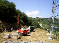
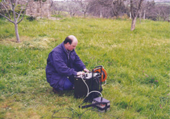
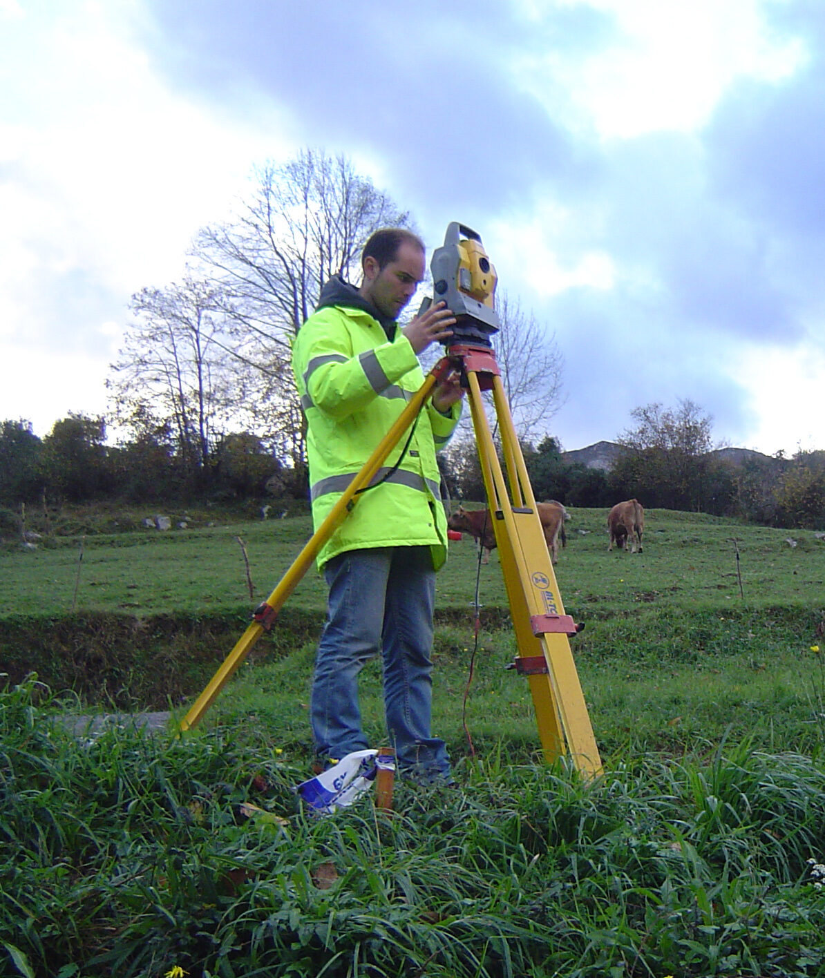
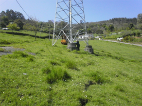
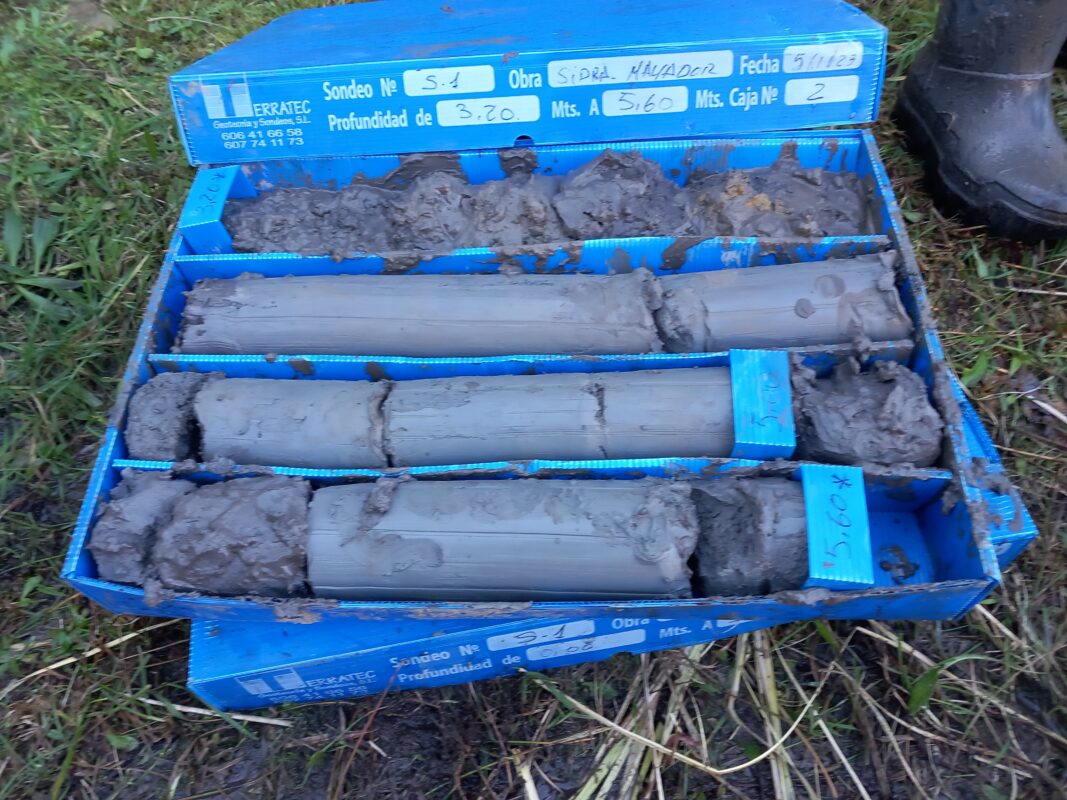
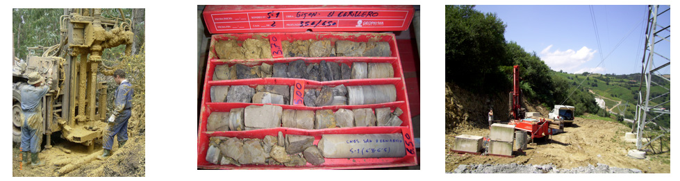
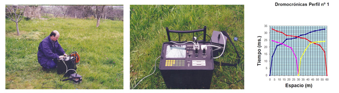
To predict the behavior of soil materials, Geomechanical characteristics must be determined by in situ and laboratory tests. With the data obtained, a mathematical behavioral model is developed to study the response to changes or surrounding conditions.

We provide a service to meet the needs of civil works professionals (Engineers, Architects, promoters and builders etc.), in the execution of the project.

Our specialists have more than 25 years of experience in the field and we have the latest generation technical software that is constantly updated.

FIELD WORK (MECHANICAL SURVEYS, CALICATAS AND PENETROMETERS ETC.).

Geoda is a company specialized in carrying out mechanical rotation surveys with continuous core extraction and roto-percussion, dynamic penetration tests, pits permeability tests in drilling and in the laboratory and all types of surveys and tests to obtain the determination of the characteristics of the terrain.

Survey with witness recovery.

Geophysics

We have refraction seismic equipment, electrical tomography and georadar.

With them we carry out subsoil studies by creating geological profiles and correlations..

With these methods the modulus of elasticity can be deduced, ripability, the degree of compaction, location of rocky substrate, location of water table, location of cavities and large diameter pipes, etc.

Geophysics

Environmental impact assessment studies are carried out, with their corresponding corrective measures, geological and hydrogeological studies for landfills, request for discharge concessions, etc..

Authorized landfill in Siero

HYDROGEOLOGY and HYDROLOGY

All types of hydrogeological studies are carried out, water wells, pumping tests, open and vibrating wire piezometers, studies for discharge concessions, permeability tests, including management and legalization of permits.

We also carry out basin studies for pipe sizing, drainage works, sanitation and everything related to the hydrological cycle.

Topography

Geoda has a team of technicians trained in topography and with extensive experience both in the field and in the office making graphic representations of the terrain with its natural and artificial shapes and details., in planimetry and altimetry. All types of topographic maps are made using the representation system of bounded plans based on relative or absolute coordinates. (Coordenadas U.T.M.).

We monitor projects in layout and cubing of the land in small and large works.

Establishment of topographic base U.T.M coordinates. in Grandas de Salime, Asturias.

AUSCULTATION AND INSTRUMENTATION

Slope stability studies are carried out, moving slopes and we analyze the safety indices, its causes and corrective measures.

  • Measurement of horizontal earth movements by inclinometers
  • Measurement of vertical earth strains by incremental extensometry or rod extensometers.
  • Measurement of ground settlement: topographic leveling or extensometers .
  • Vibrating wire piezometers sensor measurement cable: piezometers, extensometers, pressure cells, fisurometros, etc
  • Auscultation work in tunnels : convergence measurements with strain gauge tape or topography, rod extensometers, etc
  • Control of construction movements by manual surveying, semi-automatic or automatic. Leveling, etc
Cracks in a landslide under the Electric Tower and on a National Highway and typical profile of a landslide, affecting a road
Typical profile of a slope slide, affecting a road
Inclinometric Probe
Inclinometric Probe

Laboratory

We use soil and rock mechanics laboratory tests that are necessary for our work.

BUILDING AND REHABILITATION PATHOLOGY

Studies are carried out on the state of buildings in relation to the subsoil, taking care of foundations and containment structures and reform and rehabilitation projects in civil works and building..

Knowing the characteristics of the soil and subsoil with the greatest impact on the evolution of the building once built and interpreting the geotechnical work carried out to diagnose the problems of the soil and subsoil in relation to the building, The different most appropriate underpinning and rehabilitation techniques will be studied and recommended..

  • Foundation diagnostics, fissures, cracks, collapses and other symptoms.
  • Geotechnical studies to diagnose foundation problems.
  • Soil improvement technique. Compaction and consolidation.
  • Calculation and execution of surface underpinnings.
  • Calculation and execution of deep enhancements. Micropilotes.
  • Recommendations for foundations on expansive clays.
  • Pathology of retaining walls, screens and piles.
Detail of a building underpinning